Jayanta Biswas
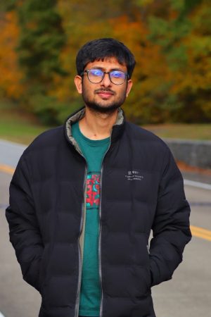
Jayanta Biswas
Jayanta Biswas is a Ph.D. student and Graduate Research Assistant in the Department of Earth, Environmental, and Geographical Sciences at the University of North Carolina at Charlotte. He is a member of the GeoHealth Dynamics Research (GeoHDR) Lab and the Center for Applied Geographic Information Science (CAGIS), working under the advisement of Dr. Yao Li.
His research focuses on Geospatial Artificial Intelligence (GeoAI), knowledge-guided deep learning, fine-scale human mobility downscaling, satellite remote sensing, and spatial epidemiology. Currently, he works on developing mass-conserving U-Net deep learning ensembles in PyTorch that fuse multi-source environmental covariates (~5.5 km to 100 m) with WorldPop and mobile data to predict Human-Vector Contact Zones (HVCZ) for precision malaria modeling in Zambia.
For detailed information about the lab’s research, please visit the lab website: https://geohdrlab.com/ and his personal portfolio: https://biswasjayanta.github.io/
Prior to joining UNC Charlotte, Jayanta was a Graduate Research Assistant at the University of Memphis. There, he led facility-level spatial econometric and two-stage least squares (2SLS) modeling for a Tennessee Department of Transportation (TDOT) and Federal Highway Administration (FHWA) research project examining induced travel demand and highway expansion. He has also served as an Assistant GIS Trainer, delivering coursework in Google Earth Engine and cloud geoprocessing, and has worked as an urban planning researcher on transit accessibility at Khulan University in Bangladesh.
Areas of research interest:
- GeoAI & Knowledge-Guided Deep Learning
- Spatial Downscaling & Multi-Source Data Fusion
- Human Mobility Modeling
- Spatial Epidemiology & Precision Public Health
- Satellite Remote Sensing & Earth Observation
- Urban Environmental Sustainability & Ecological Indicators
Advisor’s name: Dr Yao Li
Selected Publications:
- Biswas, J., & Biswas, N. (2026). Improved remote sensing ecological index for monitoring urban sustainability: 100 resilient cities vs. non-resilient cities in South Asia. Environmental Monitoring and Assessment, 198(4), 309.
- Biswas, N., Biswas, J., Shahid, I. U., & Sabuj, M. H. (2025). Mapping wildfire dynamics: GeoAI-driven comparative analysis of deep and machine learning ensembles for susceptibility prediction in California. Geomatica, 77(2), 100081.
- Biswas, J., & Antipova, A. (2025). Land development 1985–2023 as a function of road improvement, employment, and mobility: A case study of Tennessee. Land, 14(5), 1025.
- Biswas, J., Malaker, T., & Mollick, T. (2025). Tourism and environmental change in Saint Martin Island, Bangladesh: Insights from remote sensing data. Remote Sensing Applications: Society and Environment, 37, 101484.