Charlotte Heat Mappers release data from 2024 Urban Heat Island mapping campaign

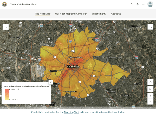
The Charlotte Heat Mappers, a multidisciplinary research team led by Drs. Katherine Idziorek, Matthew Eastin, and Michelle Zuñiga, have released the final report and dataset resulting from their 2024 Urban Heat Island mapping campaign. The community science effort, supported by funding from the National Integrated Heat Health Information System (NIHHIS), engaged more than 60 volunteers to collect fine-grained temperature and humidity data across 100 square miles of the city’s Urban Heat Island to learn more about the varied impacts of extreme heat on Charlotte communities. The Charlotte Heat Mappers are currently working with the City of Charlotte’s Office of Sustainability and Resiliency, the Mecklenburg County Emergency Management Office, and community stakeholders to develop strategies for mitigating urban heat in Charlotte communities.
The Charlotte Heat Mappers’ StoryMap, created by graduate research assistant Joe Wiswell, includes an interactive map of the heat index data and shares the results of the community science campaign as well as contextual information about the dangers of extreme urban heat.
The full report, compiled by CAPA Strategies and the GIS dataset (traverse vectors and areawide “heat map” rasters) are available here. See also news coverage by WFAE 90.7 and Qcitymetro.